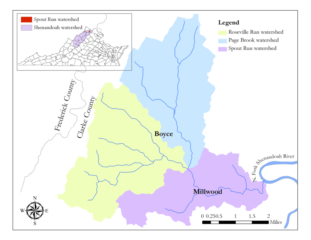
Spout Run is formed by the confluence of Page Brook and Roseville Run. The only other named tributary in the basin is Westbrook Run. In total, there are 14 miles of perennial streams in the watershed. About two-thirds of the land area is in agricultural use, with most of the remainder covered by forests. Because many of the streams are spring-fed, the watershed has potential to support enhanced fish and aquatic invertebrate species, which would support the Virginia Wildlife Action Plan. In addition to Virginia’s TMDL for Spout Run, the Chesapeake Bay Program has identified the region as a priority agricultural watershed for phosphorus and included it in the second quartile among sources of urban nitrogen.While Virginia has completed 690 TMDLs, only 39 currently have implementation plans in place, according to a state report.The U.S. Environmental Protection Agency (EPA) has a nonpoint source “Success Stories” webpage that lists only two watersheds in Virginia.
The Spout Run watershed has several unique traits that make implementing a comprehensive watershed plan by 2015 an achievable goal:
- The Spout Run watershed encompasses about 1,400 households. It is small enough that real progress can be made relatively quickly on a watershed scale.
- Clarke County residents have a history of taking action to protect open space and water quality, including enacting restrictive zoning and subdivision ordinances in the early 1980s and permanently protecting nearly 20,000 acres of private land under voluntary conservation easements.
- Since 1997, local water quality has been monitored according to an approved QAPP (Quality Assurance Project Plan) by The Friends of the Shenandoah River (FOSR),and as part of this project citizen monitoring will increase from one to five locations in the Spout Run watershed.
The Spout Run watershed also has several features that make it a relevant model for many other communities in the Shenandoah Valley:
- Raising cattle and hay are the primary agricultural activities, as elsewhere in the region.
- The same nonagricultural water-quality issues exist as in many other communities: stormwater management, streambank erosion, and failing septic systems.
- Spout Run lies on karst terrain, which can provide an open pathway between surface runoff and groundwater in at least 29 counties in western Virginia.